





In this article
What makes the South so different?
The south of Bonaire is flat, barren, and open. You drive there on a narrow road with the sea on one side and enormous salt flats on the other, with hardly any buildings in sight. It is precisely this emptiness that makes an impression. Within a half-hour drive from Kralendijk, you are in a landscape that looks like nowhere else on the island.
This South Bonaire route takes you past the salt pans, slave huts, the lighthouse at the southern tip, and Sorobon Bay in one day, with plenty of spots to go into the water along the way. The route is a loop: you drive down along the coast and return via the interior. Getting lost is virtually impossible, as there is only one main road.
Figure on about sixty kilometers for the entire loop. That doesn't sound like much, but with the many stops and the low speed on the coastal road, it will take you a whole day.
| Time | Stop | Why |
|---|---|---|
| 9:00 - 12:00 | Te Amo Beach or a snorkeling spot | The water is then at its clearest and calmest |
| Late morning | Salt pans and slave huts | Not yet the hottest hours, little traffic |
| 13:00 - 17:00 | Willemstoren at the southern tip | Rough coast, wind, and view |
| Afternoon | Sorobon on Lac Bay | Shallow water, a drink, cool off |
| End of day | Back via the inland waterways | Chance of seeing flamingos in low light |
Swipe the table sideways to see all columns.
Along the coast to the south
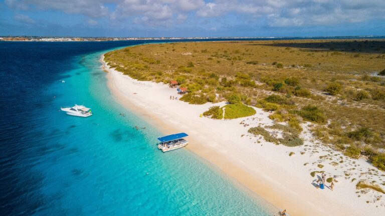
Leave Kralendijk early and drive south along the coastal road. Just outside the city center, you’ll pass Te Amo Beach and a series of snorkeling spots with yellow rocks along the road. Start with a short snorkeling stop while the water is still calm. Later in the day, the wind picks up and the surface becomes choppier.
You can find out more about these places in our guide to Te Amo Beach in our guide about the best snorkeling spots on Bonaire. Watch where you park carefully. The shoulder is narrow, and traffic passes regularly that you won't see coming until the last minute.
The yellow stones along the road bear the name of the place behind them. Remember a few that you like, and you'll know exactly where you want to return later.
The salt pans and the slave houses
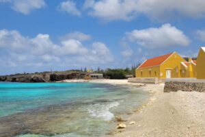
After the first few kilometers, the landscape changes. To the left are the salt pans with white salt mountains, and on the sea side are the colorful obelisks with slave houses next to them. Take your time here. The houses are a memorial site and not a photo opportunity, so walk around them quietly and do not sit on or in them.
The background information on what you see can be found in our guide to the salt pans and slave huts of Bonaire. The area around the ponds is private property. Stay on public roads, do not climb over fences, and do not drive between the panels.
There’s a strong smell of salt and brine near the pools. That’s just part of the experience, and it’s one of those things you never really get to experience in photos.
Willemstoren at the southern tip
At the end of the coastal road stands Willemstoren, the island’s old lighthouse. It’s a barren, windswept spot where the waves crash hard against the rocks. The contrast with the tranquil west coast is striking. It’s only here that you realize just how strong the trade winds really are.
Stay away from the rocks. The waves crash against them at unpredictable heights, and the surface is both sharp and slippery. This is often the windiest spot of your day. Open your car door carefully, because the wind will snatch it right out of your hand.
Lots of washed-up plastic washes ashore on this side, carried by the currents from the sea. It's confronting and it's one of the reasons why clean-up campaigns are regularly held on the island.
From the southern tip to Lac Bay
From the southern tip, drive up along the eastern side toward Lac Bay. The landscape becomes more rugged here, and you’ll see the mangroves lining the inner part of the bay. Sorobon Beach is a natural spot to stop for the afternoon. The water there is shallow and calm, there’s a breeze, and there are beach clubs where you can grab a bite to eat and a drink.
More about that can be found in our guide to Sorobon Beach and Lac Bay. This stretch is less traveled than the coastal road. Take your time, because this is exactly where you’ll see the landscape change from barren to lush.
On the way, you can already see the windsurfers out on the water before you even reach Sorobon. On a windy day, there are dozens of sails out on the water.
Kayaking through the mangroves along the way
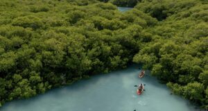
If you want to make this route more than just a round trip, you can start the morning by kayaking through the mangroves of Lac Bay and then continue on by car. You’ll paddle with a guide through the narrow tunnels between the roots, where young fish grow up. You can find more information about this in our guide to kayaking in the mangroves of Bonaire.
Book the kayak tour in advance and plan your itinerary around it, as departure times are fixed and groups are small.


Back via the inland waterways
The return route takes you through the southern part of the park, along the shallow inland waters where flamingos can be found. The light there is beautiful in the late afternoon. You might have a chance to see them, but they’re wild animals, so you can never be sure. Stay on the road and use binoculars.
More about that can be found in our guide to Spotting flamingos in Bonaire. Drive slowly on your way back. In the twilight, donkeys and goats regularly cross the road, and you won't see them until late against the dark background.
Have your binoculars ready at this spot. The birds are usually a short distance from the road, in the shallow water.
How long does the route take?
The drive alone takes less than two hours. But with stops for snorkeling, the salt pans, the lighthouse, and an afternoon on Sorobon, you can easily fill an entire day. If you want to keep it shorter, skip Sorobon and stick to the coastal route. That way, you’ll be done in half a day.
It also pairs well with a visit to the Donkey Sanctuary, which is located on the same side of the island. See our guide to the Donkey Sanctuary on Bonaire. Don't schedule anything too tight at the end of the day. You'll naturally end up spending more time on the road than you expected, especially by the water.
If you want to have lunch along the way, Sorobon is the most convenient place. Elsewhere along the route, your options are limited to whatever you've brought with you.
Drive yourself or go with a guide?
Driving yourself gives you freedom, and the road is easy to navigate. What you miss is the context, because the salt pans and the little houses only take on meaning when someone tells you the story behind them. An island tour usually combines the south with the north, allowing you to see both sides in a single day but leaving you with less time at each stop.
The consideration is in our guide about rental car or excursions on Bonaire in our guide about the best island tours on Bonaire. If you like, you can combine the two: start with a guided tour at the beginning of your trip, and later return on your own to the places you liked best.
What to bring
Water is the most important thing—you’ll need more than you think. There’s practically nothing for sale along the way, and there’s no shade anywhere. Also, be sure to bring sunscreen, a hat, sunglasses, your snorkeling gear, and water shoes. Fill up your gas tank before you leave and bring some cash.
A complete list is in our guide on what to pack for Bonaire. Bring a towel and a change of dry clothes, even if you don't plan on swimming. Chances are you'll end up doing it anyway.
Where does this day fit into your trip?
Take this route during the first half of your vacation. That way, you’ll immediately see which snorkeling spots and beaches you’d like to visit again later. Don’t combine it with a day of diving or a long boat trip. A day in the sun down south is more tiring than it seems.
A complete weekly schedule can be found in our guide to Bonaire in 7 days. If you only have one day on the island, for example, arriving by cruise ship, a shortened version of this route is quite feasible. More on this can be found in our guide to Excursions from the Bonaire cruise port.
Preferably choose a day without much cloud cover. The landscape in the south thrives on light, and in gray weather, it loses some of its power.
Frequently Asked Questions about the South Bonaire Route
How long does the South Bonaire route take?
Driving alone doesn't even take two hours. With snorkel stops, the salt pans, the lighthouse, and an afternoon at Sorobon, it's a full-day program.
Can you drive the route with a regular rental car?
Yes. The roads in the south are paved and easy to drive on. Different conditions apply to the north and Washington Slagbaai.
What is the best order?
Start at the coast with snorkeling in the morning, then visit the salt pans and the lighthouse, and finish at Sorobon. On the way back along the inland waters, you'll have the best light.
Can you buy food and drinks on the go?
On the way in the south, hardly any. At Sorobon there are beach clubs, but for the rest of the route, bring your own water and something to eat.
Will you see flamingos on the way?
You might have a chance on the inland waters, especially at the beginning and end of the day. They are wild animals, so it's never certain. Stay by the road.
Is this route suitable for children?
Yes, as long as you build in enough breaks. Alternate the stops with time in the water, and take the heat and lack of shade into account.
Would you prefer to ride along and hear the story? Then check out which activities and excursions fit your trip.
 Things to do on Bonaire when it rains
 North Bonaire Route: Rincon, Goto Lake, and Nature
 Bonaire in 10 days: complete travel planning
 Bonaire in 14 Days: Complete Travel Planning